The day didn't start too promisingly. The weather forecast was predicting that any early showers would clear away and the sun would be shining by 9am, but as I read that forecast then looked out of the window it was snowing. False alarm; the snow and drizzle was clear by 10am, and this turned out to be an even better day for weather than yesterday.
From Langdon Beck to Dufton the Pennine Way again follows the River Tees valley, but gone are the gentle leafy pastures we passed through yesterday. Now the river is faster flowing but shallower as it passes through the steep sided valleys upstream. Strangely this section of the Pennine Way heads south-west, so at the end of the day we were actually further south than when we started. I suppose this so that the next high peak, Cross Fell, can be included in the Pennine Way, as well as the very picturesque River Tees sections.
The walking guides warn that in several places today the path along the Tees disappears amongst the boulders that have fallen down the north side of the valley. Slow going even on a dry day like today, but this must be a treacherous path after rain.
 |
| Upper Tees near Merrygill |
Yet more Juniper along the banks of the river here, especially on the south side of the valley, and profusely covering an island in the river where presumably no sheep can nibble the low-growing bushes in the hard winter when little else is available. Where the path briefly diverges from the river at Lingy Holm a sheep lay dead by the path, apparently uninjured, and not obviously in lamb. It can't have been dead long as the eyes were still intact. Unfortunately we were at least a couple of miles from the nearest farm so reporting the animal wouldn't have been easy. I wonder if the farmer would do anything with the body anyway, unless it had died of something infectious.
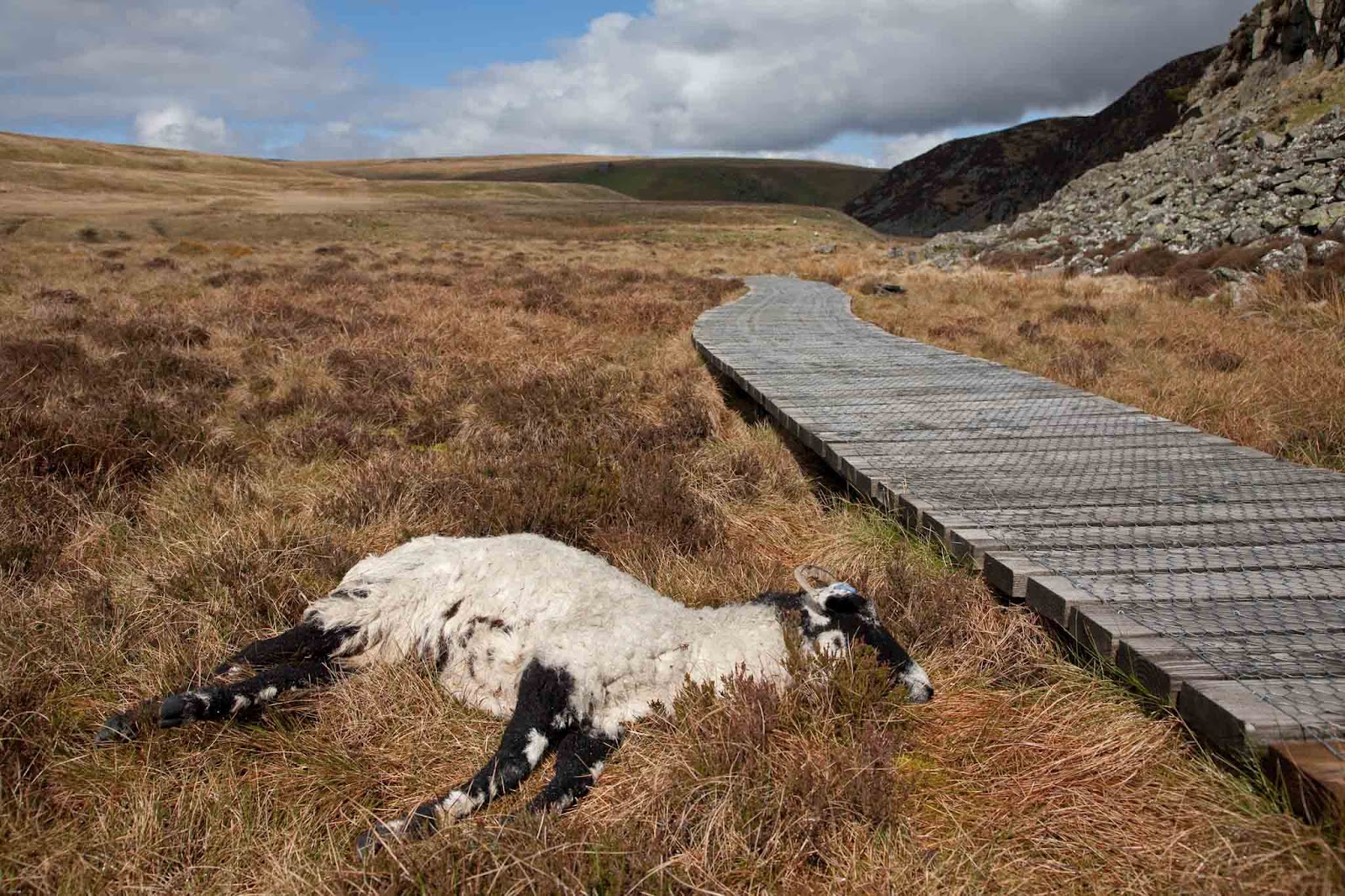 |
| Dead sheep at Lingy Holm |
Half a mile further upstream is the famous Cauldron Snout waterfall, another spectacular cascade today after the past few days' rain. I rather prefer High Force myself, but it's nice to have a choice of 3 different shapes of waterfalls within so short a distance.
 |
| Cauldron Snout |
Above Cauldron Snout is the Cow Green Reservoir which was built in the 1960s to supply the water requirements of Teesmouth. Interestingly water isn't pumped from the reservoir; instead it is simply used to regulate the level of the Tees so that water can always be extracted downstream. Seems like a good idea, as it means that the wildlife that depend on the river also get the benefit.
 |
| Cow Green Dam |
After Cow Green Reservoir the Pennine Way now separates from the river for several miles, and the Warcop military training area covers much of the area south of here. Today red flags were flying over the warning signs, so maybe there were training exercises taking place somewhere, although we didn't see or hear anything. All the way from Cow Green the path is slowly ascending at a gentle gradient so that eventually we were at about 580m. Since there was a cold easterly wind today the sun had little effect on the temperature, and as we headed higher we were walking in three layers and gloves for much of the time. Managed to find a convenient shake hole for lunch, and suddenly it was warm again.
 |
| Shake hole lunch |
Just west of the lunching hole we reached High Cup Nick, undoubtedly the high point of the day, and possibly of the whole walk so far. Spectacular views down his deep and wide glacial valley, with steep cliffs and rock pillars on both sides. There was a real satisfaction in reaching this vantage point, since there is really no other way to get here.
 |
| High Cup Nick panorama |
For another mile or two the path follows high up along the north edge of the valley, and we were looking down from high on tortuous stone walls built along the stream at the valley bottom, and spotting isolated sheep that had ventured high up on the opposite side. Eventually the path starts to descend towards the wide valley of the River Eden, where Dufton is the first town we reach, and tonight's stop.
 |
| Descent from Hugh Cup - barn at Hartwaite |
Tomorrow will be the hardest day so far, with the path climbing nearly 800m in the first half of the day. The walking guide says that the average temperature over the year on the peaks here is just 4C, and that severe gales are common. Also the weather forecast for tomorrow says heavy rain. Wish us luck.
If you would like to donate to the MND Association, please visit http://www.justgiving.com/PhilipJAWhite
This log is really bringing your trek to life for me, and seeing you both head through the sodden terrain is very heart warming. Hope the walk on Sunday goes OK, as the Met Office even mention its going to be hard work for walkers in the Pennines.
ReplyDelete