As the song says, What a difference a day makes. Although the weather forecast had changed overnight from pretty much "all sunshine" to "might be a bit of sun if you're lucky" that was more than enough. Combined with the drop in wind speed from somewhere around 40mph to 20mph that was enough to allow the plan outlined yesterday to work. The gist of the plan is that we would walk the Dufton to Garigill section of the Pennine Way in reverse, since we were staying in Garigill last night, so we didn't need to miss out anything of the official Pennine Way.
This section of the Pennine Way is a special one, taking in Cross Fell, the highest peak of the Pennine Way, and the highest point anywhere in England outside of the Lake District. Cross Fell is one of a set of 3 high peaks, the others being Great Dun Fell and Green Fell, making this the "largest block of high ground in England", whatever that means, according to Wikipedia.
Approaching Cross Fell from the Garigill side isn't really very exciting, with a gravel and rock track taking up most of the distance, climbing slowly for about 600m (2000 feet) over 5 miles. That was OK though, since today's weather forecast was predicting fog until early in the afternoon, so there was no real prospect of views until we were near the peak, whichever way we approached it. That proved to be right, and most of the way up were were stuck in some sort hybrid fog/low cloud, and lucky to see more than 50m ahead.
 |
| Cross Fell ascent |
 |
| Cross Fell snow |
 |
| Greg's Hut - don't ask for a hot pasty |
 |
| Inside looks a bit Tibetan with the flags |
Soon after this the path heads off left (south) towards the peak of Cross Fell, about 200m higher. Almost immediately it becomes impossible to spot where the path is, sometimes it's a stream, sometimes it's a field of rocks, and sometimes there are a few flagstones. In weather like today's, when visibility was no more than 50m at the best of times, it would be hard to imagine navigating this without a GPS.
Eventually we reached the summit of Cross Fell, the ultimate peak of the Pennine Way, so here goes with the spectacular views... Of course we didn't expect anything today, given the low cloud we were walking in, so weren't disappointed. At the summit there's the expected trig point and one of the 4-way loose stone shelter seats that we saw on Shunner Fell.
 |
| Cross Fell - brought to you by Mars |
Since we're doing this section in reverse the next peak to be reached was Great Dun Fell (848m), a couple of miles south. Great Dun Fell has a radar tracking station on the top, part of the air traffic control system, although it looks rather military. The path between each of the peaks was again very difficult to find today, being shrouded in cloud much of the time. The radar station shown below was one minute in brilliant sunshine and the next completely hidden in the cloud.
 |
| Great Dun Fell radar station |
 |
| Green Fell - two of its many cairns |
After Green Fell we started the descent to Dufton, which was by now being revealed in brilliant sunshine down in the Eden valley. This part of the walk became a real pleasure once the sun finally came out at about 3pm. The grass and stones were dry from the still fresh breeze, and we had magnificent views in all directions apart from back up to the peaks. Briefly the clouds parted, giving us a view back up to Cross Fell.
 |
| View back to Cross Fell |
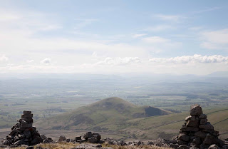
I thought it might be worth sitting in the same spot which was yesterday's limit, and taking the same picture of Knock Fell through "those two cairns". Looks rather different today.
 |
| Knock Fell in the sun |
About an hour later and we were back in Dufton, which is becoming very familiar. Jonathan went back to yesterday's B&B to reclaim a book he'd left there, and I headed to the Stag Inn to wait. Unfortunately the pub doesn't open until 6pm on weekdays, so I ended up just waiting outside in the sun, but what a lovely novelty.
I had phoned Discovery Travel this morning to explain our new plans to them. Since the original plan required taxi to&from Slaggyford I negotiated a trade-in for a single journey back from Dufton. That was a good deal since this would otherwise have been an £50 taxi fare.
So, back in Garigill now, having had another good stodgy meal at the George & Dragon. Tomorrow's another long day, 21 miles onto Greenhead. Another county and our first contact with Hadrian's Wall.
If you would like to donate to the MND Association, please visit http://www.justgiving.com/PhilipJAWhite
No comments:
Post a Comment